
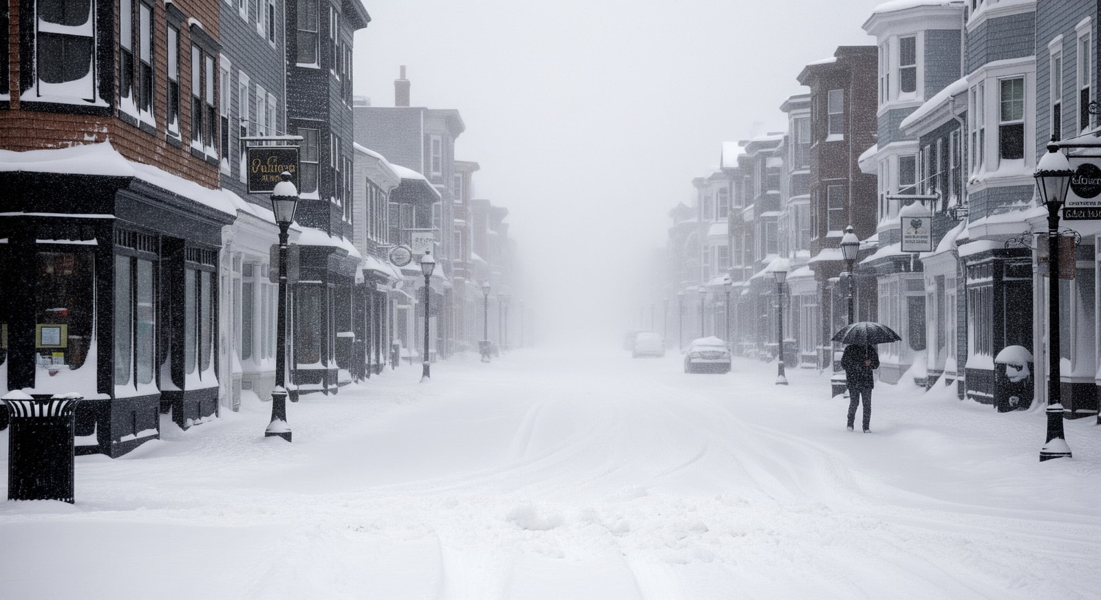
A Massachusetts snowstorm dropped up to 3 inches of snow per hour across the North Shore on February 7, 2026, producing whiteout conditions and major travel disruptions.
Summary: A Massachusetts snowstorm on February 7, 2026, produced intense snowfall rates of up to 3 inches per hour along the North Shore, forcing travel advisories, school and business closures, and widespread snow clearance operations.
A fast-moving winter system struck the North Shore of Massachusetts on February 7, 2026, producing a Massachusetts snowstorm that dumped snow at rates reaching 3 inches per hour and creating hazardous, near-whiteout conditions for coastal communities.
Storm Overview and Affected Areas
The most intense snowfall was reported across cities on the North Shore, with Beverly, Gloucester, Salem and nearby towns bearing the brunt of the storm. Snow accumulated rapidly on roadways, sidewalks and vehicles, and some locations recorded double-digit totals before the heaviest bands moved out.
Meteorological Causes
Forecasters said the event combined an Arctic airmass with a classic winter clipper system. That pairing produced localized heavy snow bands typical of fast-moving clippers, allowing intense bursts of snowfall to develop over eastern New England within a short period.
Warnings and Official Advisories
By midday on February 7 the National Weather Service issued multiple winter storm warnings and snow advisories for the North Shore, urging residents to remain indoors and avoid travel during peak snowfall periods. Local authorities reiterated the risks of low visibility and slick roadways.
These are the types of snowstorms that can severely affect travel conditions with little to no warning. The heavy snow and low visibility are significant safety risks for motorists and pedestrians alike.
Impact on Travel and Daily Life
Roads became dangerously slick and visibility fell dramatically as heavy snow piled up and winds led to drifting. Many drivers found conditions nearly impassable, prompting travel advisories and widespread calls to postpone non-essential journeys until roads were cleared.
- Cities hardest hit: Beverly, Gloucester, Salem, Lynn and Cape Ann area
- Snowfall intensity: up to 3 inches per hour in localized bands
- Community response: school and business closures, snow-clearing operations
- Public safety: emergency services on high alert and slower response times due to snowdrifts
Local Response and Recovery Efforts
Public works crews and emergency teams worked through the storm to clear main routes and respond to incidents, though deep drifts and ongoing snow limited movement. Officials advised residents to clear vents, check on vulnerable neighbours, and allow plows to pass by avoiding parked vehicles on narrow streets.
What This Means for Travelers
Travelers in or planning to transit the North Shore should expect ongoing road and service disruptions in the immediate aftermath. Those with essential travel needs are advised to check local advisories, allow extra time for journeys, and carry winter emergency supplies in vehicles.
So what? The rapid snowfall and low visibility during this Massachusetts storm underscore the need for caution: travel can become unsafe with little warning, and recovery—clearing roads and restoring normal services—may take several days in impacted communities.
Sources