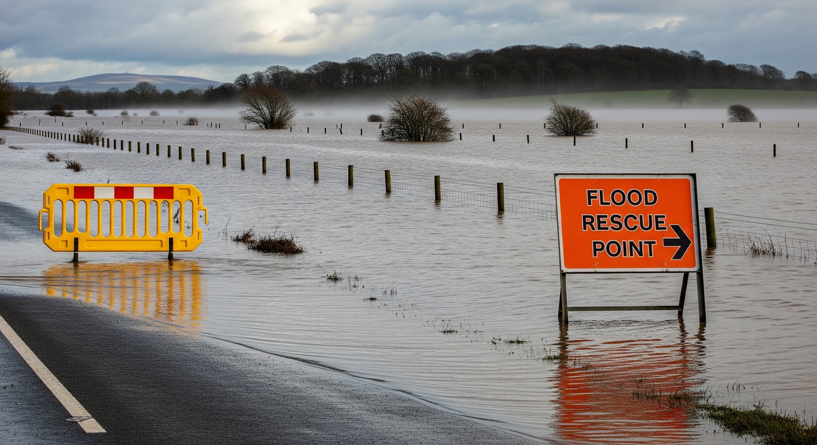
UK flood warnings remain active across many regions, with nearly 90 alerts in place and forecasts warning that rain will be followed by snow and ice.
Summary: Nearly 90 flood warnings remain across the UK after an exceptionally wet January. More rain is forecast this Wednesday and Thursday, and a change to colder weather on Friday could bring snow and ice, increasing risks and travel disruption.
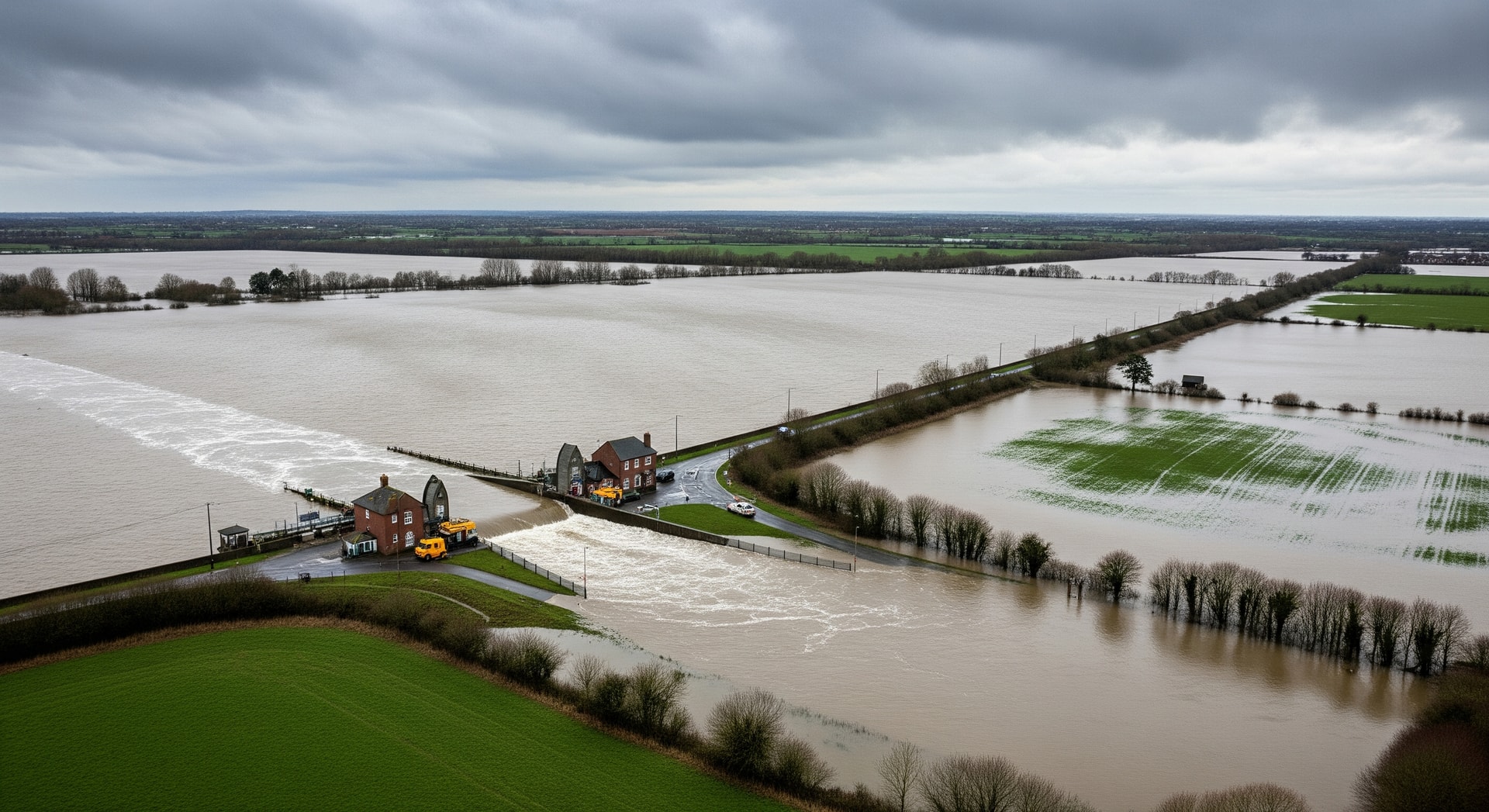
UK flood warnings cover large parts of the country as waterlogged conditions persist following an unusually wet winter. Nearly ninety flood warnings are in force, concentrated in southern England and parts of Scotland, with communities continuing to contend with standing water and river breaches.
Where Flooding Has Been Worst
Southern counties such as Dorset and Somerset have suffered repeated inundation as rivers and saturated ground overflow. Cornwall and County Down recorded their wettest January on record, and northern parts of the country have also seen significant rainfall and flooding.
Immediate Forecast and Changing Conditions
Forecasters expect further rain this Wednesday and Thursday, which will raise water levels in areas already affected. Those locations currently flooded are likely to receive more water before any recovery can begin.
Weather patterns are set to shift on Friday when colder air moves in. That change will bring the possibility of snow and ice, especially across northern parts of the UK, and has prompted health alerts where temperatures are expected to fall sharply.
- Nearly ninety flood warnings currently in place, focused in southern England and parts of Scotland
- Cornwall and County Down recorded their wettest January on record
- Additional rain expected this Wednesday and Thursday
- Cold change arriving Friday with increased chances of snow and ice, particularly in the North
- River Severn and River Trent are slow to respond and will take longer to recede
Risks from Wet-to-Cold Transition
As wet conditions meet colder air, the chance of snowfall increases and mixed precipitation can exacerbate flooding. The combination of rain, snow and ice raises the risk of what has been described as 'wild flooding' in some areas, while icy surfaces will make road travel more hazardous.
Why Some Rivers Take Longer to Recover
The River Severn and the River Trent respond slowly to heavy rainfall, meaning floodwaters along their courses will remain for an extended period. Although river warnings may ease as flows move toward the sea, authorities warn that risks can persist while waters slowly recede.
Local officials have urged communities to stay prepared and to follow guidance, since the slow-moving nature of these rivers means recovery will take time even after rain eases.
Authorities' Advice and Alerts
The Environment Agency and the Scottish Environment Protection Agency (SEPA) continue to issue flood estimates, safety guidance and social media updates for people in at-risk areas. Health alerts have been issued in places expecting sharp temperature drops.
While more settled weather could begin by the end of the month, current warnings mean communities and travellers should plan for ongoing disruption and avoid non-essential journeys in affected areas until conditions improve.
What This Means for Travellers and Local Communities
Travel disruptions, road closures and localized evacuations remain possible while flood warnings are active. The incoming cold snap could introduce snow and ice that compound travel hazards and slow recovery efforts.
So what? If you are in or planning to travel to affected parts of the UK, check local flood warnings from the Environment Agency and SEPA, allow extra time for journeys, and be prepared for both additional rain and colder conditions with the potential for snow and ice.
Sources