The Dientes de Navarino Circuit is Chile’s southernmost multi-day trek, a remote 50 km loop near Puerto Williams that few hikers attempt each year.
Summary: The Dientes de Navarino Circuit on Navarino Island is a remote, roughly 50 km multi-day trek near Puerto Williams. Usually completed in 4–5 days by fewer than 2,000 hikers annually, it requires full self-sufficiency and is best attempted in the southern summer (December–February).
The Dientes de Navarino Circuit is Chile’s southernmost multi-day trek, tracing a rugged loop across Navarino Island just south of Puerto Williams. For hikers seeking solitude and raw Patagonian landscapes, this route offers jagged peaks, glacial tarns and expansive valleys far from the crowds found on more famous trails.
A Remote Wilderness: The Southernmost Trek
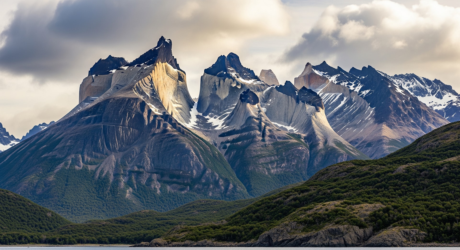
The Dientes de Navarino are a serrated mountain chain on Navarino Island, located just south of Puerto Williams — the world's southernmost town. The circuit delivers a profound sense of isolation and wilderness; roughly 2,000 trekkers complete the route each year, making it far quieter than well-known Patagonian hikes such as Torres del Paine or the W trek.
What Makes the Dientes Circuit Unique?
Unlike more trafficked routes, the Dientes Circuit threads through a subantarctic environment that includes peat bogs, wetlands altered by beavers, and high alpine terrain ringed by sharp summits. The highest point of the range, Pico Navarino, tops out at just over 1,195 meters (3,921 feet), yet the glacial lakes and forested valleys give the landscape an imposing, remote character.
Route Overview: Distance and Duration
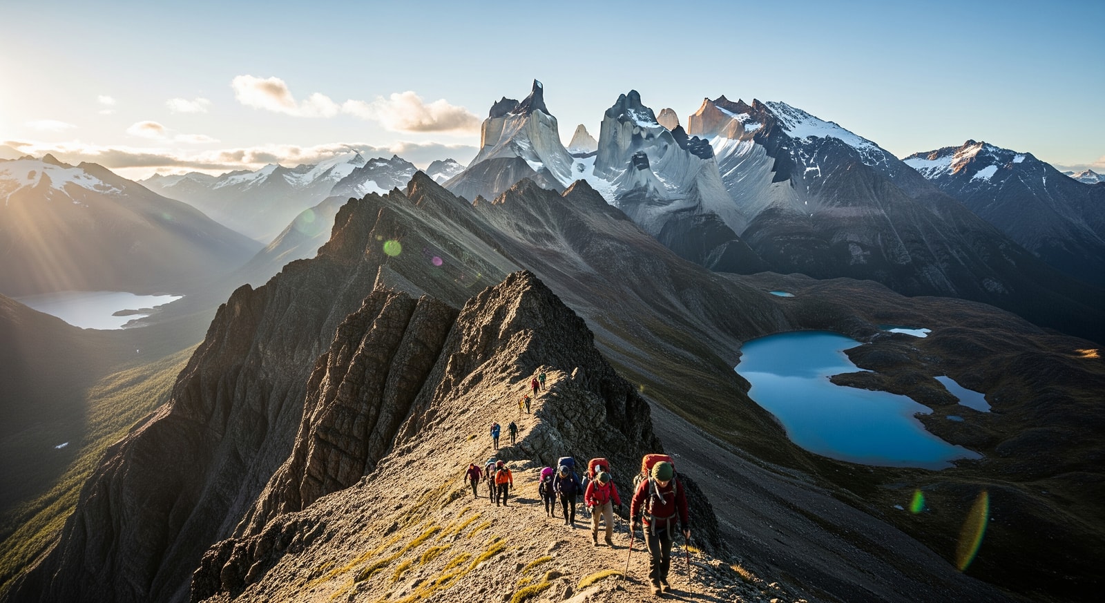
The full loop covers approximately 50 kilometres (31 miles) and is typically completed over 4 to 5 days. Although the mileage is moderate, the rough terrain and fickle weather can make progress slow and demanding, so careful planning is essential.
- Stage 1: Puerto Williams to Laguna Salto — Nothofagus forest and first campsites
- Stage 2: Dientes Pass and alpine ridgelines — steep ascents and exposed paths
- Stage 3: Guerrico Valley and glacial lakes — Laguna de los Dientes and Laguna Escondida
- Stage 4: Virginia Pass and return — highest pass with coastal descent back toward Puerto Williams
Terrain, Weather and Preparation
Hikers should expect muddy tracks, rocky scree, steep ascents and exposed ridges. Weather can flip quickly — rain, snow and strong winds are common — and some trail sections are faint, so solid navigation skills are important. There are no huts or refugios along the route; trekkers must carry all equipment, food and shelter and be fully self-sufficient.
Best Time to Hike the Circuit
The southern summer — December through February — offers the most favourable conditions, including long daylight hours and relatively more stable weather. Nonetheless, trekkers should always check local trail reports and register with authorities in Puerto Williams before setting out.
Why Choose Dientes de Navarino?
For experienced trekkers who value solitude and untouched scenery, the Dientes Circuit is a rare opportunity to explore one of the last wild corners of Patagonia. The combination of dramatic topography, glacial lakes and limited visitor numbers creates a deeply rewarding, if demanding, wilderness experience.
Why this matters: For travellers and the adventure tourism sector, the Dientes de Navarino Circuit represents both an exceptional low-impact tourism product and a challenge for logistics and safety. Prospective hikers must be prepared, self-reliant and respectful of the fragile subantarctic environment — doing so ensures an unforgettable journey to the southern edge of the world.
Sources