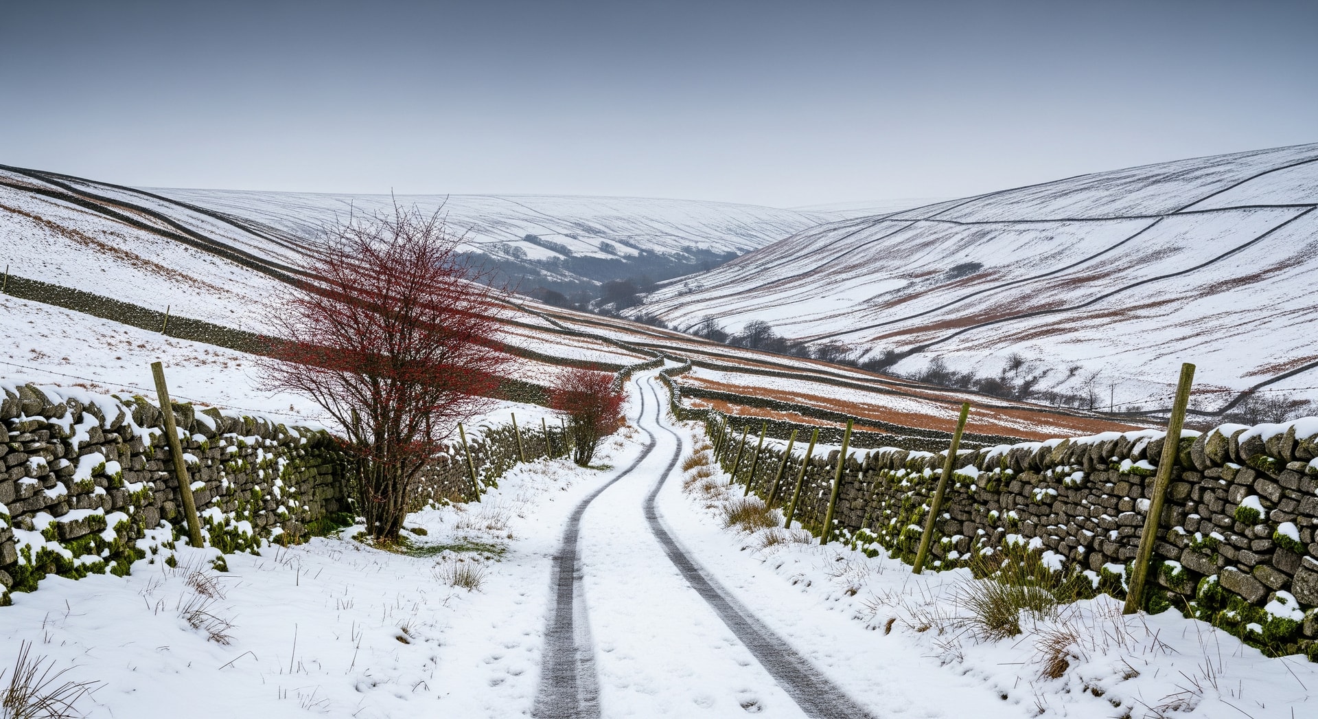
Yorkshire Dales snowstorm warnings: heavy snow and temperatures feeling as low as -9C are expected to cause widespread travel disruption across northern England and the Midlands.
Summary: A Yorkshire Dales snowstorm will bring heavy snow and temperatures that may feel as low as -9C, starting Friday and spreading south through the Midlands and Home Counties, with flood warnings in low-lying river areas.
The UK faces a sharp weather change this week as forecasts indicate a Yorkshire Dales snowstorm and widespread freezing conditions. The Met Office warns that snow showers will become more widespread from Friday, with the heaviest falls expected in northern England and temperatures that may feel as low as -9C, creating conditions likely to disrupt travel and daily routines.
When and Where to Expect the Snow
According to forecasts from the Met Office and reporting by the BBC, the first snow showers are expected on Friday morning in the northeast of England. Northumberland and the North Sea coastline should see the initial significant snowfall by mid-morning, before the band of snow moves inland.
- Friday midday: snow spreading across Yorkshire, the East of England and North Wales
- Friday afternoon: a snow band moving into much of the Midlands
- Friday evening: southern movement affecting Home Counties including Buckinghamshire, Berkshire and Oxfordshire
Impact on Travel and Business
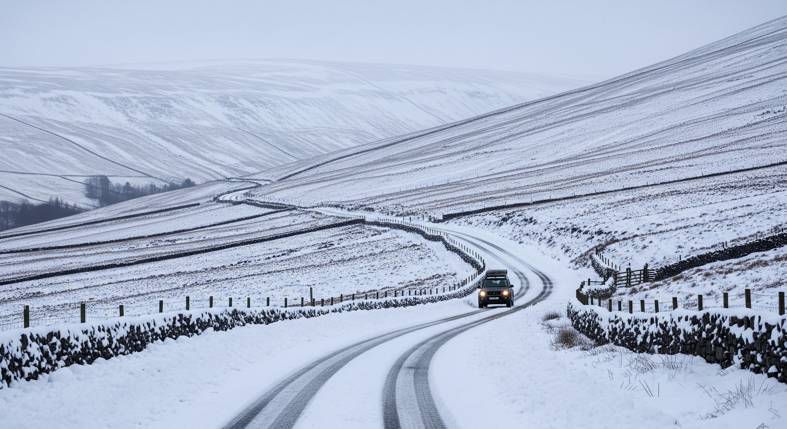
The incoming snow and the very cold temperatures are likely to cause delays and disruptions to public transport and road networks. Regions already highlighted as vulnerable include the East of England, East Midlands and parts of the Home Counties, where accumulated snow can slow bus and rail services and affect commuting patterns.
Drivers should expect difficult conditions where snow builds up, with longer journey times and potential route closures. Travelers are advised to factor in extra time for journeys, check service updates and consider postponing non-essential travel during peak snowfall.
The Weather Outlook: Saturday and Sunday
Saturday should bring drier, sunnier weather for many areas, but conditions will not remain settled. Forecasts indicate that snow will return on Sunday, with the heaviest falls expected in the Yorkshire Dales and the Scottish Borders. The north of the country will see intensifying snowfall as the weekend progresses.
While some southern parts, including London, may avoid snow on Sunday, heavy rain is possible there. Visitors planning outdoor activities or excursions should monitor local forecasts and check attraction statuses before traveling to avoid last-minute cancellations.
Flooding Concerns Amid Heavy Rainfall
Alongside the snow, persistent heavy rain has prompted multiple flood warnings. Communities close to the River Severn, River Trent and sections of the River Thames are particularly at risk. Authorities have cautioned that blocked weather patterns could extend periods of rain and increase flood risk in vulnerable areas.
The Environment Agency has urged people in affected areas to remain alert and follow official advice on road closures and safety measures, especially where previous rainfall has already saturated the ground.
Quick Travel Tips for Tourists
- Check live updates from the Met Office and BBC for timing and severity of snow and rain.
- Allow extra time for travel; expect delays in the East of England, Yorkshire and the Midlands.
- Dress in layers and bring thermal wear, gloves and scarves for temperatures down to -9C.
- If driving, ensure tires are suitable and carry emergency supplies such as blankets, water and snacks.
- Avoid routes marked as flooded and heed local diversion signs near the River Severn, Trent and Thames.
How the Snow Will Affect Tourism
Tourist visits to outdoor attractions and countryside sites may be interrupted as venues close or access routes become unsafe. Operators running countryside excursions or guided walks should expect cancellations or reduced attendance. Conversely, snow accumulation could boost interest from winter-sport visitors heading to ski areas in the Scottish Highlands and parts of the Yorkshire Dales, provided conditions are safe and facilities are open.
Visitors are advised to confirm bookings and transport arrangements ahead of travel and to maintain flexible plans while the weather system progresses across the UK.
Why this matters: For travellers and the travel industry, the Yorkshire Dales snowstorm means planning for delays, prioritising safety and monitoring flood warnings. Anticipate longer journey times, possible event or attraction closures, and alter itineraries where necessary to avoid disrupted routes. Staying informed and prepared will reduce risk and help travellers make safer choices during the freeze and associated weather impacts.
Sources